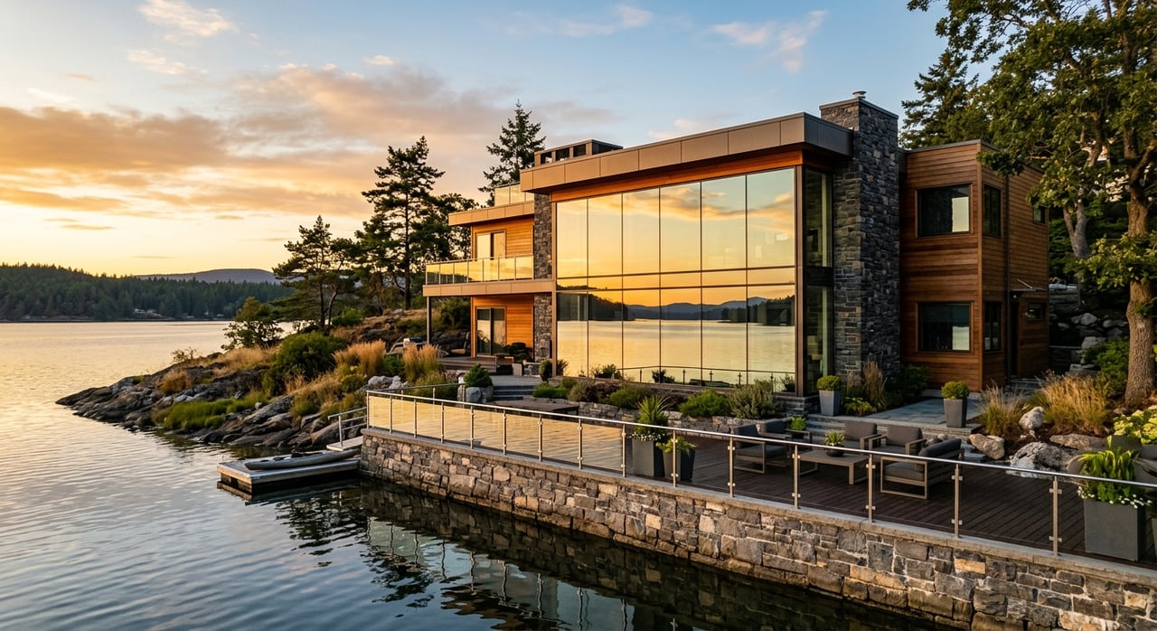
Thinking about a place on Smith Lake near Arley but unsure how changing water levels could affect your day-to-day use? You are not alone. Many buyers focus on views and square footage, then discover later that water depth, dock design, and cove conditions can make or break the experience. In this guide, you will learn the practical ways Smith Lake’s levels can influence your search in Arley and what to look for so you can buy with confidence. Let’s dive in.
Smith Lake levels 101
Smith Lake, officially Lewis Smith Reservoir, is a hydroelectric reservoir created by Lewis Smith Dam. Alabama Power owns and operates the lake, managing generation schedules, flood control, and dock permitting on Alabama Power property. Water levels change with hydropower operations, rainfall and runoff, seasonal weather patterns, and occasional maintenance or downstream needs.
In general, levels rise after wet periods and fall during dry spells or when operators release water for power or flood control. The exact timing and magnitude vary year to year, and extreme storms or droughts can create bigger swings. For context on regional inflows, you can review historical streamflow through USGS Water Data for Alabama.
Alabama Power publishes current lake levels and historical charts for Smith Lake. Ask for recent elevation data when you tour so you can compare what you see on site to typical seasonal conditions.
What level changes mean for your shoreline
Shorelines react differently to the same water level, and the slope matters more than many buyers realize.
- Low-water periods can expose more shoreline, leaving mud or rock where you expected water. Shallow, gently sloped areas may become less usable for swimming or launching small craft.
- High-water periods can temporarily reduce usable yard space and may submerge low steps or portions of a fixed dock if levels rise above typical summer conditions.
- Steeper drop-off shorelines tend to maintain usable depth over a broader range of lake levels, which helps with swimming and boat access when the lake is lower.
When you walk a lot, look for a consistent drop-off, not broad mudflats. Ask for photos of the shoreline during different seasons to see how it behaves.
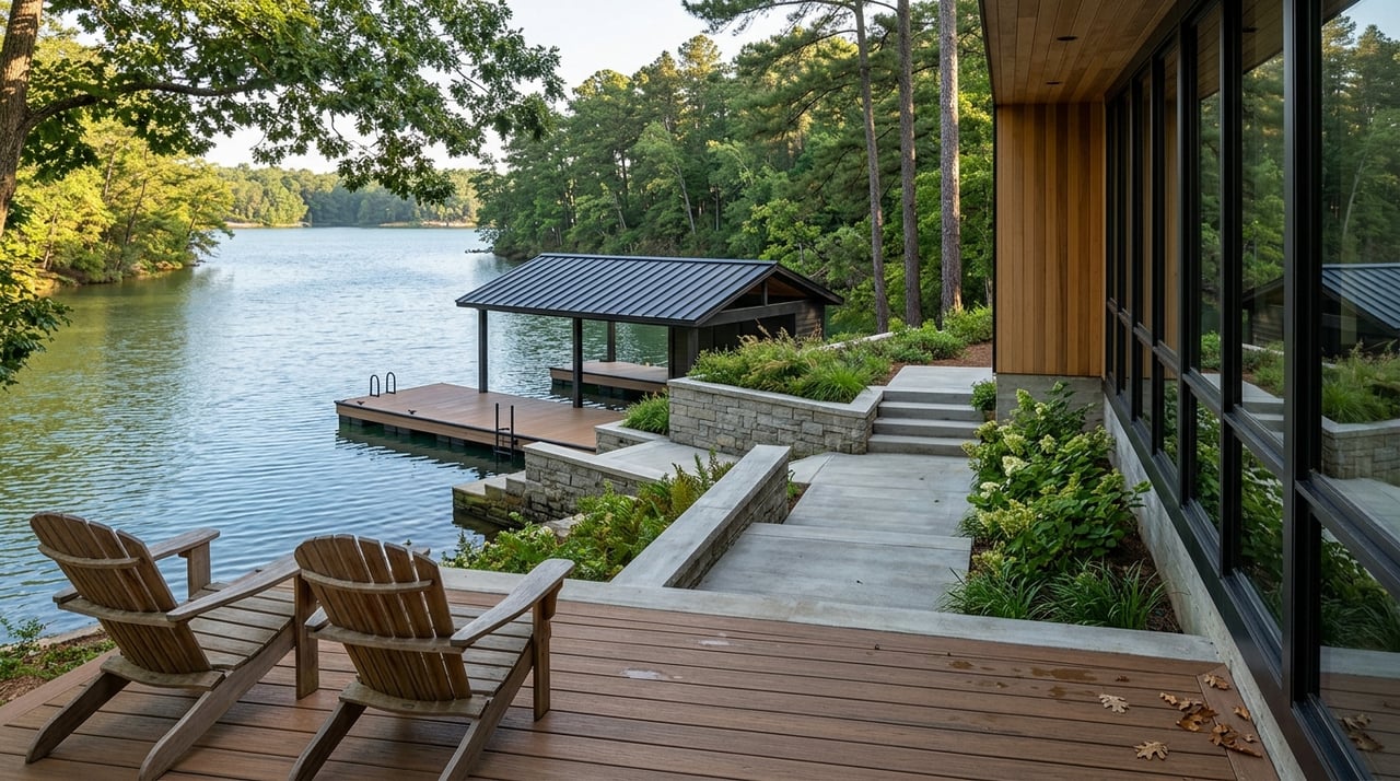
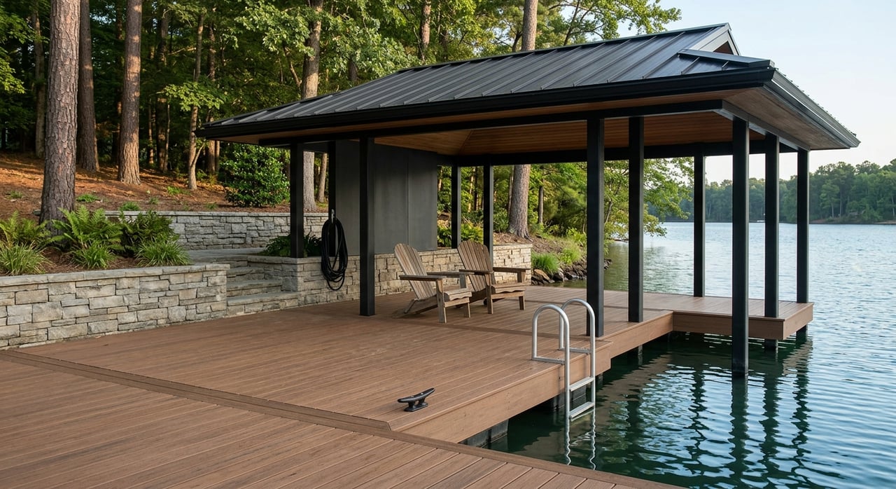
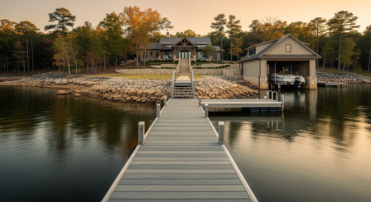
Docks and dependable boat access
Your dock design should match the lake’s variability. Here is what to weigh as you compare properties in Arley and nearby coves.
- Floating docks with adjustable gangways typically handle multi-foot fluctuations well. They maintain access when levels change.
- Fixed piers or pilings that were set to a particular elevation may become unusable in low water or be partially underwater at high stages.
- Dock permitting on Smith Lake is managed by Alabama Power. Confirm that an existing dock is permitted and ask whether the permit is transferable. If no dock is present, verify whether the property is eligible for a new permit before you commit.
- Shared or community docks can be convenient, but you should review HOA rules, potential wait lists, and shared costs in writing.
- Boat ramps, both public and private, can become shallow or unusable at low water. If ramp access is important, verify usability across seasons.
Pro tip: ask sellers for depth measurements at the end of the dock tied to a known recent lake elevation. This gives you a practical, apples-to-apples metric as levels change.
Main channel vs coves around Arley
Where a property sits on the lake affects boating and enjoyment, especially at lower stages.
- Main-channel or deep-water frontage usually stays navigable for larger boats across normal fluctuations.
- Side coves and shallow arms can experience bigger depth swings. Some narrow or shallow cove entrances may be impassable at lower levels, and certain coves may be too shallow for motorized boats during dry periods.
If year-round boating matters to you, prioritize main-channel frontage or proven deep water. In coves, look for a clear entrance channel and ask for depth readings from recent low-water periods.
Erosion, shoreline work, and long-term care
Repeated level changes, especially rapid ups and downs, can accelerate shoreline erosion. Many lots use riprap, seawalls, or vegetative buffers to protect banks. These improvements may require permits from Alabama Power and sometimes county or state environmental authorities.
Ask for documentation of any past erosion control work, including permits and maintenance records. Understanding what has been done and when helps you assess long-term care and costs.
Septic, wells, and drainage near the lake
Lakeside utilities deserve special attention.
- High lake levels can raise the local water table, which may affect septic drainfield performance on some lots. Local health regulations require setbacks from the shoreline and soil testing. Obtain inspection records and verify that the system meets Winston County approvals.
- Wells near surface water can be influenced after high-water events. It is prudent to test for bacterial contamination if there has been recent flooding.
- Good site drainage is essential. Look for well-drained areas uphill from the lake for septic systems and ask about any recent upgrades.
Your agent can help you request percolation test results, recent pump records, and county documentation before you finalize terms.
Flood risk and insurance checks
Flood risk around lakes is based on FEMA flood maps and local base flood elevations, not just a property’s appearance from the shoreline. Some waterfront parcels may fall within mapped flood zones or experience temporary inundation during extreme events.
Before you offer, enter the address in the FEMA Flood Map Service Center to review flood zone status. If a lender requires flood insurance, this will affect your carrying costs. A survey or elevation certificate can provide more precise information for underwriting.
How to shop smarter in any season
Water levels change, so try to see how a property functions at more than one stage.
- If levels are low during your tour, request recent historical charts from Alabama Power to gauge whether the current stage is typical or unusual.
- Ask for photos of the shoreline and dock from different seasons. Seeing both high and low conditions helps you understand the property’s range.
- Request measurements of depth at the end of the dock tied to known recent elevations. This anchors expectations for boating at different times of year.
- Review the dock permit, any recorded easements, and a survey that shows the shoreline reference line used for permitting.
If you cannot time multiple showings, a targeted document review can fill the gap and protect your decision.
Arley buyer checklist: features to favor
Look for lot traits that minimize seasonal impacts and support consistent use.
- Steeper shoreline slope that holds depth during low-water periods
- Main-channel frontage or verified deep-water access year-round
- Adequate upland setback between the house and the lake’s typical high-water line
- Floating dock or adjustable gangway with a transferable dock permit
- Established erosion control, with permits and maintenance history
- Well-drained site with septic documentation and recent inspection
Red flags to pause on:
- Broad, shallow mudflats in front of the lot during low water
- No dock permit or unclear rights to install or share a dock
- Visible or recurring bank erosion without a mitigation plan
- Septic system close to the shoreline without recent inspections or soil tests
Questions to ask before you offer
- Who holds the dock permit and is it transferable upon sale?
- What were the highest and lowest lake levels at this location in the past 5 to 10 years, and are photos available?
- Has the lot experienced shoreline erosion, staging work, or flooding? Any ongoing mitigation requirements?
- What is the depth at the end of the dock at the current lake stage, and what has it been at recent low levels?
- Are there HOA covenants that affect docks, shared slips, or shoreline work?
- When was the septic system last inspected or pumped, and are there percolation test results on file?
- Are there any planned operational releases or maintenance activities at Lewis Smith Dam that could temporarily change levels?
Who to contact and verify with
- Alabama Power for current lake levels, dock permits, and shoreline work guidelines. Request the latest charts and applicable permit forms for Smith Lake.
- Winston County planning, zoning, and health offices for septic, well, and building requirements relevant to your parcel.
- FEMA for parcel-specific flood mapping. Start at the FEMA Flood Map Service Center and consider an elevation certificate if needed.
- USGS for regional streamflow history that helps explain inflows to Smith Lake, available through USGS Water Data.
Bringing a marine contractor or surveyor with Smith Lake experience can also help you evaluate shoreline slope, dock suitability, and likely improvements.
Ready to find your Smith Lake fit?
Buying on Smith Lake should feel exciting, not uncertain. When you understand how water levels influence shoreline use, docks, and navigation, you can focus on properties that perform well in every season. If you want help narrowing choices, gathering the right documents, or coordinating lake-specific inspections, connect with the local team that lives and works this shoreline every day.
Have questions or planning to sell a Smith Lake property? Reach out to Unknown Company to talk through your goals or to Get a Free Home Valuation.
FAQs
How do Smith Lake’s water levels typically change over a year?
- Levels rise after wet periods and fall during dry spells or when water is released for hydropower or flood control. The timing and magnitude vary with weather and operations.
What type of dock works best on Smith Lake near Arley?
- Floating docks with adjustable gangways are generally the most resilient to multi-foot fluctuations. Fixed docks can be usable if designed to expected ranges, but verify historical performance.
How can I check if a waterfront lot is in a flood zone on Smith Lake?
- Look up the address in the FEMA Flood Map Service Center and, if needed, obtain an elevation certificate for insurance and lending.
What should I ask about a property’s shoreline before making an offer?
- Request dock permits, shoreline photos from different seasons, recent depth measurements tied to known lake elevations, and any erosion control permits or maintenance records.
Do coves around Arley stay usable for boating all year?
- It depends on depth and the cove entrance. Main-channel frontage is less affected, while shallow or narrow coves can be difficult to navigate during low-water periods. Verify depth during recent low stages.